The Water Thieves of Madeira
So here you are, standing at what looks like a quaint little park with traditional thatched houses, about to follow a glorified irrigation ditch for the next three hours. Don't worry - this particular ditch happens to be one of the most remarkable engineering achievements you've probably never heard of.
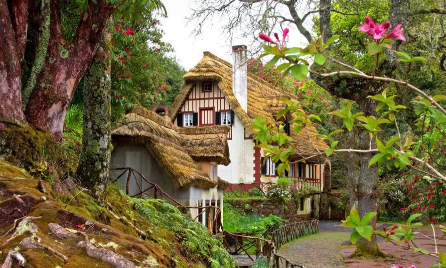
Those triangular thatched houses behind you? They're called casas de colmo, and they're not just Instagram props. Families actually lived in these things for centuries, weathering Atlantic storms under roofs made of wheat straw. The thick stone walls and tiny windows weren't charming design choices - they were survival tactics against Madeira's moody mountain weather. Notice how the thatch slopes at exactly 45 degrees? That's five centuries of trial and error talking.
But let's talk about why you're really here - to walk along what amounts to a 500-year-old water heist. The levada system you're about to follow represents the largest irrigation network on Earth, stretching over 3,100 kilometers across this volcanic rock. That's longer than the distance from London to Istanbul, all hand-carved into cliff faces by people who clearly had no concept of health and safety regulations.
The Portuguese figured out something brilliant when they arrived in the 1420s: Madeira gets plenty of rain, but it all falls in the wrong places. The north side of the island - where we are now - gets drenched year-round, while the sunny south side where they wanted to grow crops stayed bone dry. So they did what any reasonable person would do - they stole the water.
This wasn't your typical weekend DIY project. Workers called rocheiros hung in wicker baskets from ropes tied to trees, carving channels directly into basalt cliff faces hundreds of meters above certain death. Many didn't make it home for dinner. The Portuguese used whatever labor they could get their hands on - slaves from Africa and the Canary Islands, convicts from mainland Portugal, and anyone desperate enough to take the job.
The engineering precision would impress modern hydraulic engineers. These channels maintain gradients of just 1:100 to 1:1000, meaning water flows gently across vast distances while following mountain contours. Get the angle wrong by a few degrees and you've either got a dry ditch or a destructive torrent. They got it right, turning Madeira into Europe's sugar capital by the 1500s.
Today, this "borrowed" water still irrigates 20,000 hectares of farmland, provides drinking water for island communities, and generates 15% of Madeira's electricity through hydroelectric plants. Not bad for a bunch of medieval water thieves.
Your path today follows Levada do Caldeirão Verde, built in 1896 to serve the settlements around Santana. You'll walk 8.7 kilometers through UNESCO World Heritage Laurisilva forest - a 20-million-year-old ecological time capsule that survived when similar forests across Europe disappeared. The payoff? One of Madeira's most spectacular waterfalls, plus bragging rights for completing one of the world's most scenic irrigation inspections.
Quick housekeeping: those tunnels ahead are pitch black, so headlamps aren't optional unless you enjoy walking into stone walls. The path can be slippery when wet, which in Madeira means always. And yes, that handrail looks sketchy because it is - but it's held up thousands of hikers, so probably won't pick today to fail.
Ready to follow the water thieves? Your 500-year-old highway awaits.
Listen to the audio guide: